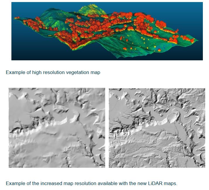
Hawke’s Bay Regional Council (HBRC), in collaboration with researchers from Manaaki Whenua, have completed a pioneering project using LiDAR (Light Detection and Ranging) technology to gain a deeper understanding of the region's landscape.
This project uses LiDAR to create high-resolution maps detailing land and vegetation across the region, providing an unprecedented level of detail on the region’s topography.
The newly developed digital elevation models (DEMs) enhance the accuracy of assessments for erosion, sediment loads in rivers, and overall landscape changes. With slope data now available at five-meter intervals (compared to the previous 25-meter intervals), these advancements significantly improve land use capability assessments.
Regional Council’s Senior Scientist Dr Ashton Eaves says, “The newly available LiDAR landscape layers represent a substantial leap forward in environmental and infrastructural planning for the region. The Regional Council will use the data to better manage erosion-prone land, update Land Use Capability (LUC) classes, and accurately identify priority biodiversity areas”.
Sam Carrick, Portfolio Leader at Manaaki Whenua notes: “This partnership really benefitted from staff of both organisations working together closely in the design and implementation of the projects. This enabled Regional Council staff to develop an in-depth understanding of our latest science advances, such as erosion modelling or the ability to map individual trees, and likewise Manaaki Whenua scientists were able to get a greater appreciation of Hawkes Bay needs and to develop tools that are directly applicable by council”.
The new LiDAR data, based on 2020 readings, is also now accessible to the public through Geographic Information Systems (GIS).
Further information
LiDAR, which stands for Light Detection and Ranging, involves precise laser measurements of the Earth's surface. This technology allows for the creation of highly accurate 3D maps of land and its features. The new LiDAR data will be instrumental for councils and various sectors by providing detailed insights into topography and the built environment.
Hawke’s Bay Regional Council, in collaboration with Central Hawke’s Bay District Council, Hastings District Council, Napier City Council, and Wairoa District Council, secured $14 million from the Provincial Growth Fund to support this project. Additionally, Manaaki Whenua Landcare Research NZ has matched an extra $500,000 contribution from the Hawke’s Bay Regional Council, enabling further development of modelling and reports derived from the LiDAR data.
The aerial survey data collection began in March 2020 and concluded in May of the same year. Despite challenges posed by the COVID-19 pandemic and extreme weather events, which led to some project delays, the data processing was completed, and the final results were delivered in June 2024. This research significantly enhances regional resilience to extreme weather conditions.

TrendForce 2024 Infrared Sensing Application Market and Branding Strategies
Release: 01 January 2024
Format: PDF
Language: Traditional Chinese / English
Page: 172
|
If you would like to know more details , please contact:
|


 CN
TW
EN


